Crop Weather Forecasting: Enabling Analysis for Grain Trading
CropProphet features a crop weather forecast that we call the “weather outlook yield forecast.” For this feature, the weather forecast models are used to drive the yield forecasts. The benefit to CropProphet customers is gaining an understanding of the risk of the change in the yield forecast 15 to 30 days into the future. This will help to manage corn and soybean futures price risks.
A new enhancement recently released allows CropProphet Enterprise users to see the best case and worst case crop yield and production forecast as implied by several ensemble weather forecast models. Our methodology to produce this important analysis is described below.
Crop Yield Modeling
CropProphet provides weather-driven crop yield forecasts focused on corn, soybeans, and winter wheat. The product, however, is much more than just a weather forecast for the corn belt. CropProphet is based on a sophisticated, machine learning-based model that relates daily weather conditions to crop yields and production.
The model itself is relatively simple. It’s based on this formula.

The yield in any year for corn, soybeans, and winter wheat is considered to be the combination of technology trends + the impacts of weather + the error. This equation, however, allows CropProphet to model yield based not only on what has happened with the weather but also based on weather forecast information. This capability is called the “weather outlook” component of the CropProphet crop yield forecasts.
CropProphet Crop Weather Forecast
The crop weather forecast used in the CropProphet’s weather outlook component are obtained from several independent weather forecast models: NOAA’s 15-day Global Forecast System (GFS) and 30-day Climate Forecast System (CFSv2), and the world-leading 15-day European Centre for Medium-Range Forecasts (ECMWF) weather forecast model. Each of these models is an ensemble modeling system, which means that each model provides a collection of “ensemble member” forecasts that are equally likely but often very different from each other. Most weather forecast maps that show ECMWF data, for example, are the average of the ensemble, as shown below.
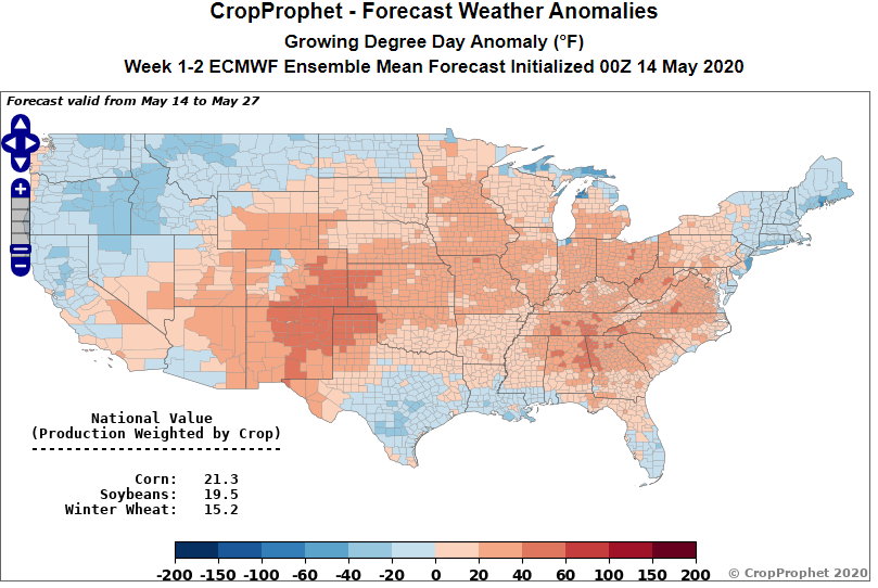
For example, the ECMWF crop weather forecast includes 51 members, and these 51 forecasts start to become different quickly after about a week. The CropProphet yield and production models are applied to each of the ensemble members in turn, leading to an ensemble of yield and production forecasts. It is also important to note that each weather forecast model (GFS, CFSv2, ECMWF) has its own systematic biases relative to the PRISM and ERA5 data that CropProphet relies on, and therefore the first step in the weather outlook process is to perform a bias correction for each county and each weather variable.
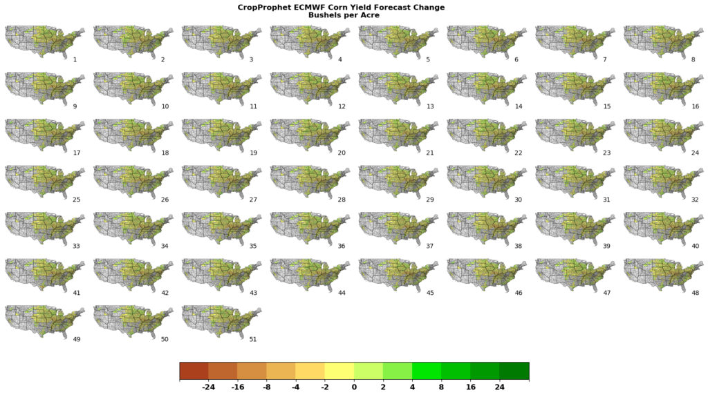
After bias correction, each of the ensemble member forecasts is used to generate a county-level crop weather forecast. These county-level forecasts are production weighted to calculate the national yield forecast. The median yield forecast of the 51 possible forecasts is considered to be the most likely case; this provides the “expected 15/30-day change” for the CropProphet interface (as in the example above).
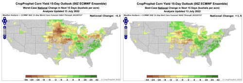
The weather outlook component has been upgraded for 2022 by implementing a number of behind-the-scenes computational refinements, and also by adding “worst-case” and “best-case” map options to the website interface.

In the examples above, the difference between the worst-case and best-case ECMWF outlooks for corn production is almost 6 bu/ac, and this represents a plausible range of uncertainty for how the corn production forecast will change over the next 14 days. The two extremes are determined by finding the minimum and maximum national aggregated yield among the ensemble members and then creating county-level maps of the forecast changes caused by those two members.
It is important to note that these maps do not represent the worst-case and best-case at each location separately because such maps would be unrealistic (i.e. no weather outcome will degrade or improve yields at all locations simultaneously). Instead, this view represents two plausible weather scenarios from the weather forecast model that result in the best and worst-case national yield and production outcomes.

Crop Weather Forecast: Ensemble Forecast
We can provide even more information about the impact of the crop weather forecast on the future corn yield forecast.
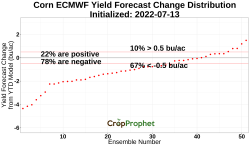
The above graphic shows the impact of each member of the ECMWF weather forecast. The ECMWF weather forecast is technically 51 equally likely possible weather forecasts. We apply the CropProphet yield forecast model to each of the 51 forecasts. This creates 51 different yield forecasts which we can compare the the “year-to-date” yield forecast. In other words, we can look at how the ECMWF forecast suggests the corn yield forecast might change over the next 14 days.
As the season advances, CropProphet’s weather outlook component will provide valuable advance warning of likely future crop weather impacts, and the new worst-case and best-case options will add a useful quantitative range of uncertainty surrounding these impacts. As always, all of the data displayed on the website interface is available for download on our SFTP server, and interested customers should inquire about Modeler options that allow for the backtesting of automated trading strategies.
Request a trial of CropProphet