Will Another 2012 Drought Emerge? – Implications for Corn Production
One Minute Summary
- There is emerging market speculation that recent hot, dry weather may presage a summer drought like 2012
- However, soil moisture is currently much higher than at this time in 2012
- Pacific Ocean climate influences do not favor a drought this summer
- CropProphet shows the precise crop-specific impacts of recent weather and of the latest weather forecast
2018 vs the 2012 drought
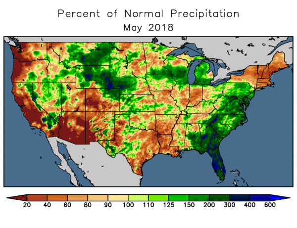
May 2018 is now in the books, and it was the warmest May on record across a large portion of the central US. Rainfall was below normal in some areas – particularly from northern Missouri to Indiana:
The hot and locally dry conditions have prompted speculation that persistent heat stress and drought may emerge for the heart of the growing season – see here for an example:
https://www.agweb.com/article/meteorologist-2018-weather-pattern-to-parallel-2012/
CropProphet enables market participants to move beyond speculative opinion to hard facts and objective realities about weather’s impacts on crops. So let’s ask how this season compares to 2012 so far. First, CropProphet data reveals that the soil moisture situation is nowhere near as bad as during the 2012 drought in was at this point in the season.
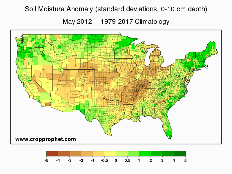
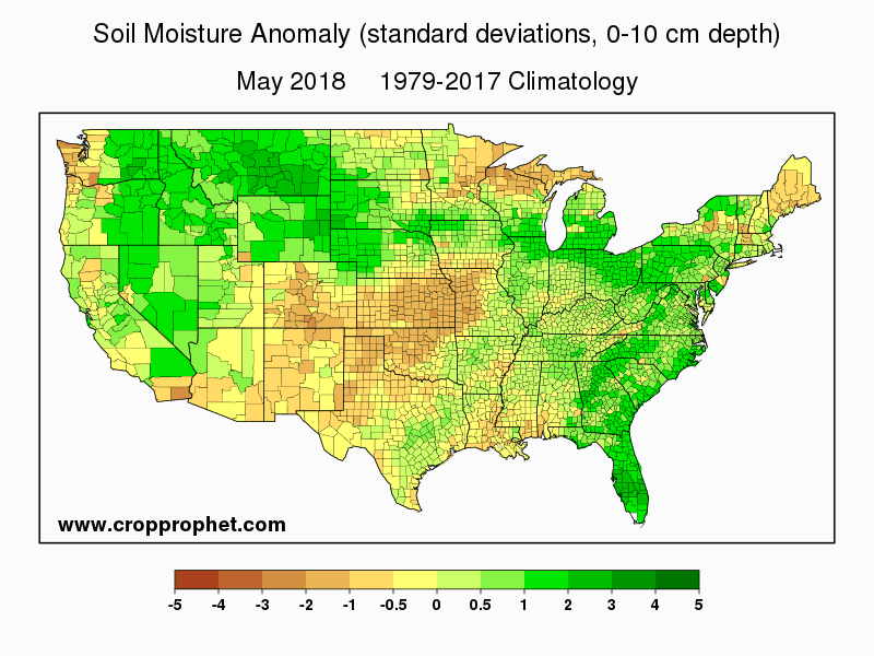
The maps below show the departure from normal of the May average soil moisture in the top 0-10cm layer, for 2012 and 2018. At the start of the 2012 drought in May 2012, soils were significantly drier than normal across most of the Corn Belt, but this year soil moisture is in good shape in most areas. Very dry conditions are evident this year from Kansas into western Missouri, but overall the moisture picture is much less concerning than in 2012. We can also compare a corn drought index time series, which is produced from the US drought monitor data. It shows drought conditions during May 2018 were much less severe than in 2012.
A second difference between this year and 2012 is that Pacific Ocean patterns strongly favored dry conditions in the summer of 2012, but the same is not true this year. The drought-related ocean pattern in 2012 was one of the most amplified on record, and this produced a dry, hot summer across the Midwest despite El Niño also occurring that summer. A common misconception is that El Niño brings a wet summer, and La Niña causes drought, but in fact the opposite occurred in 2012. This summer the Pacific patterns are weak and indistinct, suggesting that there’s no strong “forcing” to cause hot, dry weather to persist.
Corn Yield Forecast
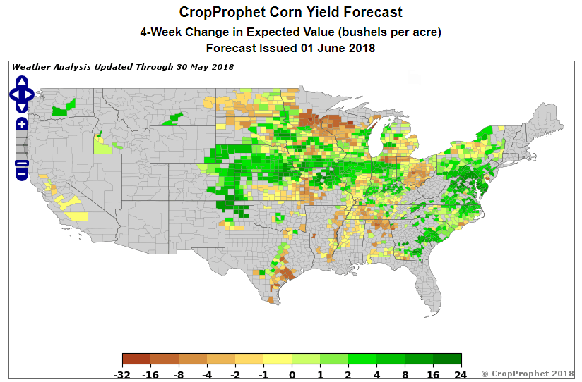
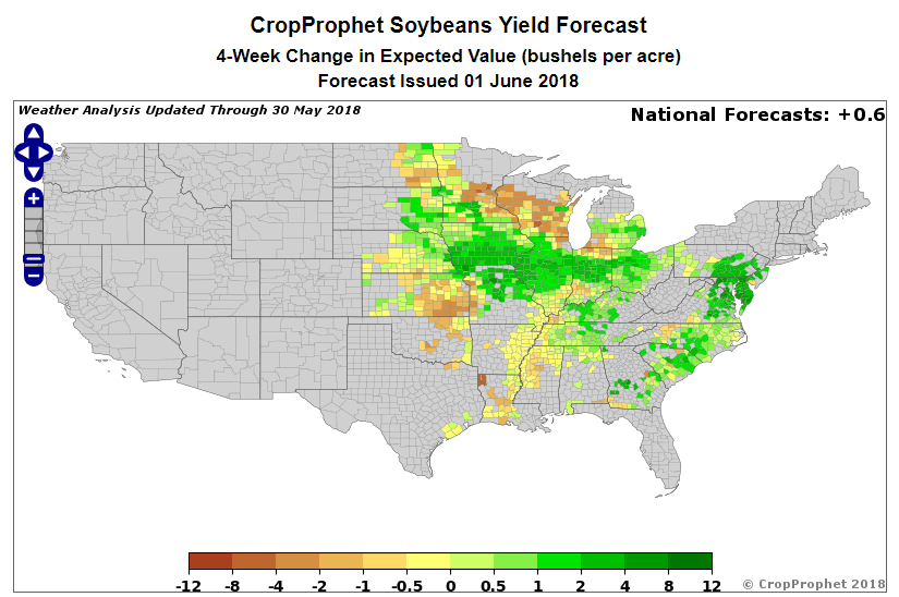
Finally, CropProphet indicates that the weather pattern is not yet having a negative influence on US corn and soybeans overall. For example, CropProphet’s county-level models show that the most likely yields have increased over the past 4 weeks in most of the key growing districts – see the maps below.
CropProphet quantifies the impact of weather on crop yields and production. CropProphet’s weather outlook component, which is part of the grain yield forecast capability, quantifies the crop-specific impacts of the latest weather forecast, also shows additional improvement in the weeks ahead. Sign up today for a CropProphet trial to view this information!
Avoid the hype. Get the facts. Use CropProphet for your Grains Market Intelligence.